Welcome to the Camping Konneys’ blog. Greg, Henry and I plan to travel the US camping in as many states as possible before old age takes over and we can’t drive the rig!
Our site at Pelican Lake Motor Coach Resort in Naples, Florida.

Welcome to the Camping Konneys’ blog. Greg, Henry and I plan to travel the US camping in as many states as possible before old age takes over and we can’t drive the rig!
Our site at Pelican Lake Motor Coach Resort in Naples, Florida.

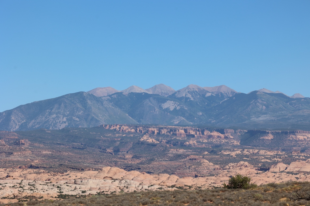
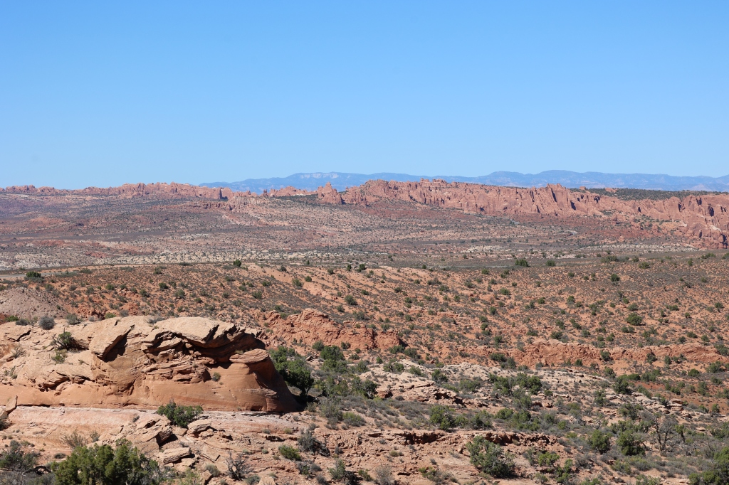
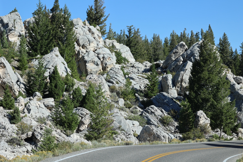
About 20 minutes from Moab are the La Sal Mountains. They’re beautiful and a little different than the red rock we had been seeing while in Utah so we decided to give the La Sal Loop Road around the mountain a try. This is a 60 mile scenic road that looks through the mountains and down to Castle Valley. It has amazing views of the Moab Valley and it climbed quite a ways in elevation, reaching 8,300 feet by the time we reached the top. And who would have known, there were cows up wandering around the road. This one was my favorite…a panda cow.

While following the winding road up through the desert plateau you’ll reach the beautiful forest covered mountains. There were several dirt roads and hikes along the road but we chose just to make the drive and enjoy the scenery on this day. Once you climb the mountain you’ll notice the scenery change and as you continue down the loop road you’ll notice the desert plains return as you make your way down to the sandy desert floor. The switchbacks were a little scary for me but the photographs I got with my camera were beautiful so it was totally worth the drive. We saw mesas and buttes and steep laccolith peaks all along the paved road. The coolest part of the ride was that you went from alpine ridges of the La Sal Mountains to the red rock desert and sandstone pinnacles of Castle Rock, all within one drive. Here are some photos from the drive.


The next day we were back at our hiking and decided to try the Corona Hike, Bowtie, and Pinto. They were all three together and were not within the park so we didn’t feel like we had to get up early to get into the park but we did want to complete the hikes before lunchtime as the temps were kinda warm in the afternoons still. The hike was great! It started along the Potash Road which follows the Colorado River west from Hwy 191. The trailhead is clearly marked about 10 miles down the Potash Road. The trail is clearly marked much like the Appalachian Trail with bluish/green “blazes”, a rectangle of paint 2 inches wide by about 6 inches high. The hike crosses open slickrock and then there’s a ladder bolted to the rock which allows people to climb a short cliff more easily. In another spot, there are steps cut into the rock and a cable aids hikers to ascent a steep slickrock ridge. At times there are cairns marking the road, other times the blazes mark the trail but it’s clearly marked throughout the entire hike. We chose to go directly to Corona Arch and then to backtrack to go to Pinto Arch which just added another mile to the hike. Bowtie Arch is passed as you get to Corona. The light was better after passing through the arch so some of our photographs were taken from the backside but both sides were lovely!

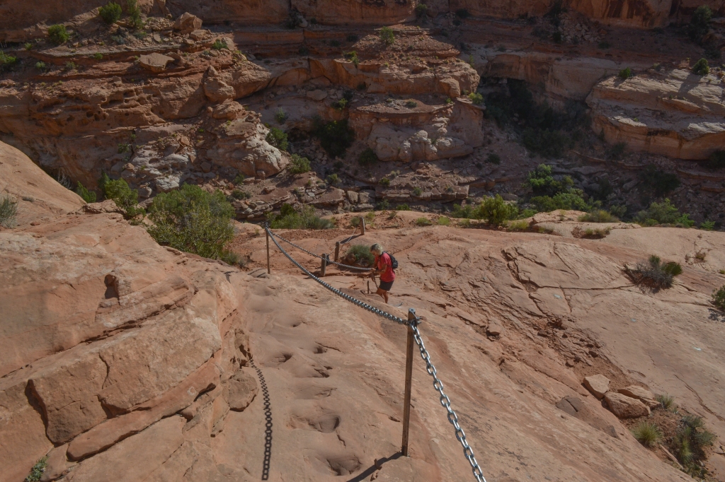

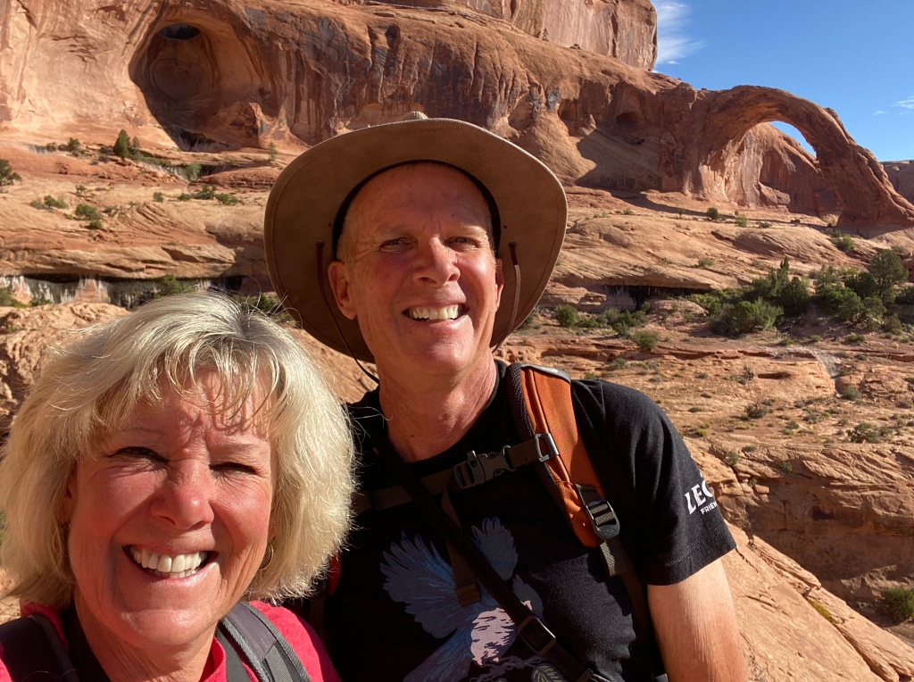


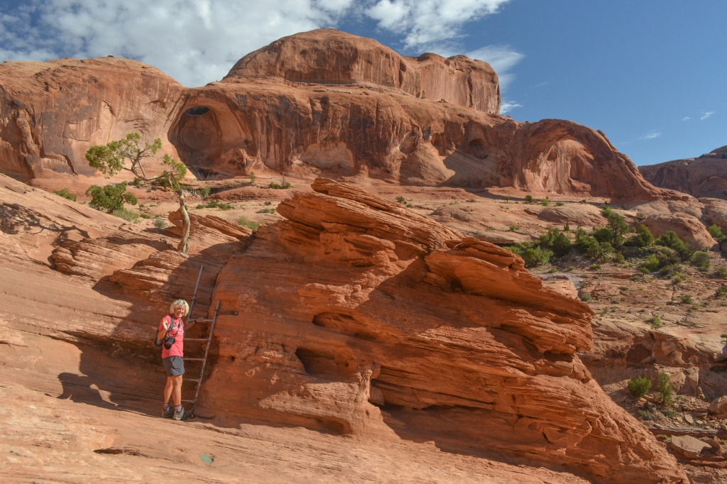


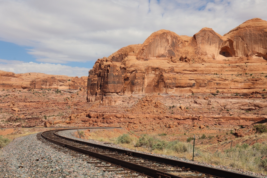


When you begin the trail you have to climb east and cross the railroad tracks and then continue along an old road that climbs to a gap. From there you follow cairns, blazes or slickrock paths. After you climb the chain and short ladder, the trail will put you on top of a large bench. The trail takes you under Bowtie Arch which is a pothole-type arch located high on the cliff above the trail. Once you pass Bowtie, the trail continues on to the base of Corona Arch. You can easily hike under it which we did and we stopped for a break and to enjoy both the shade and the view. The sky was a beautiful blue and it was truly one of the prettiest arches we hiked to on the trip.
We watched a few rock climbers along the Potash Road on Wall Street. The wall was right on the street and the cliffs were so high I couldn’t imagine anyone wanting to climb the “wall”.


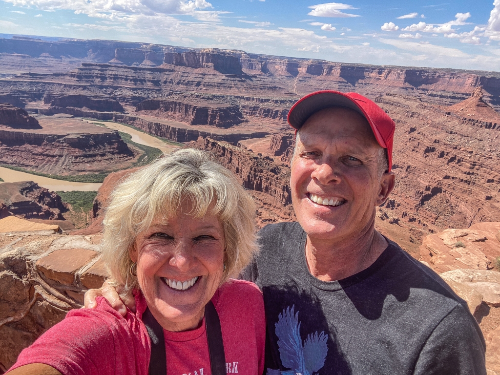
We finished our day with a quick trip to Dead Horse State Park for a picnic lunch and to see the “famous” Colorado River horseshoe view that everyone seems to want to see! Here’s the horseshoe below. Next post will be from Mesa Verde National Park in Colorado.

We’ve been in Moab, Utah for a week now and have completed all of the hikes within Arches National Park. Since we had been here 3 years ago, we felt like we knew our way around the park and had some very definite plans about which hikes and attractions we would spend our time viewing. We had reservations for 8:00 every morning for the timed entry program, so we had no trouble getting in or finding a parking place. The only problem with going in the mornings, is the light is better in the afternoon, but the sun was intense and we found that hiking in the afternoons was too hot. We stopped at all of the regular stops, Park Avenue, Sheep Rock, Three Gossips, Courthouse Towers, Balanced Rock; you get the picture. Below are some photos of these places along the main road through the park.


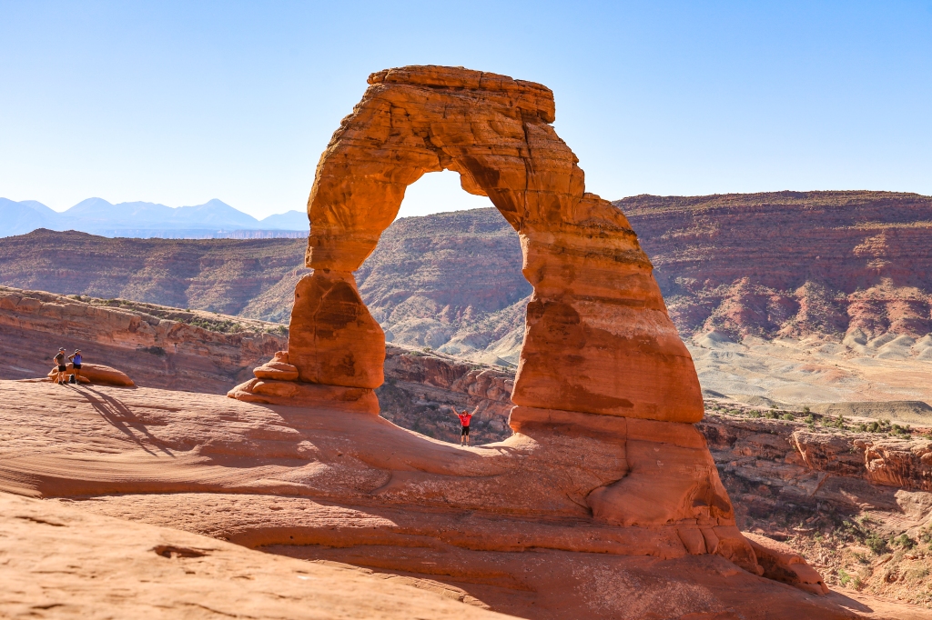
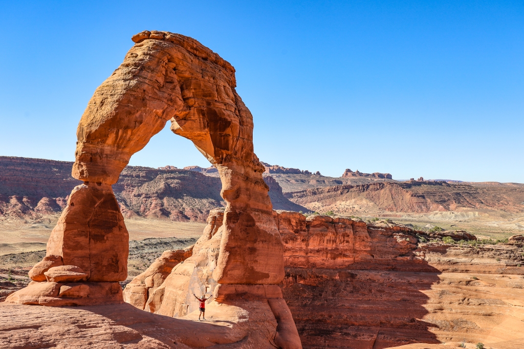
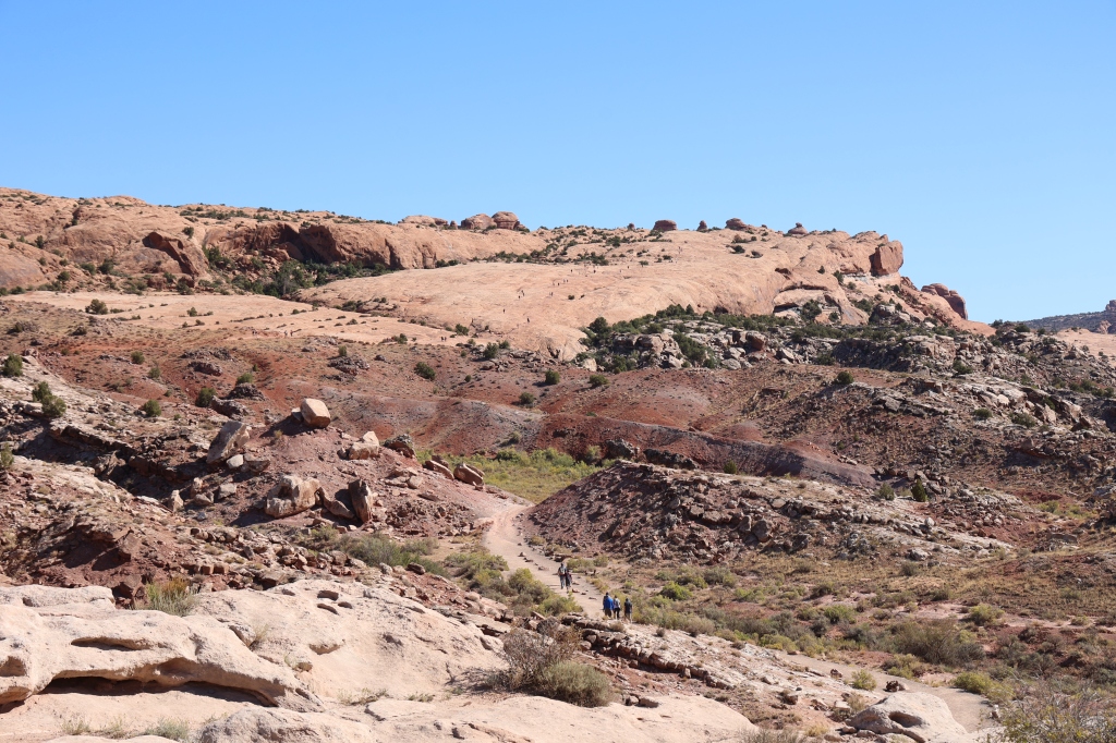
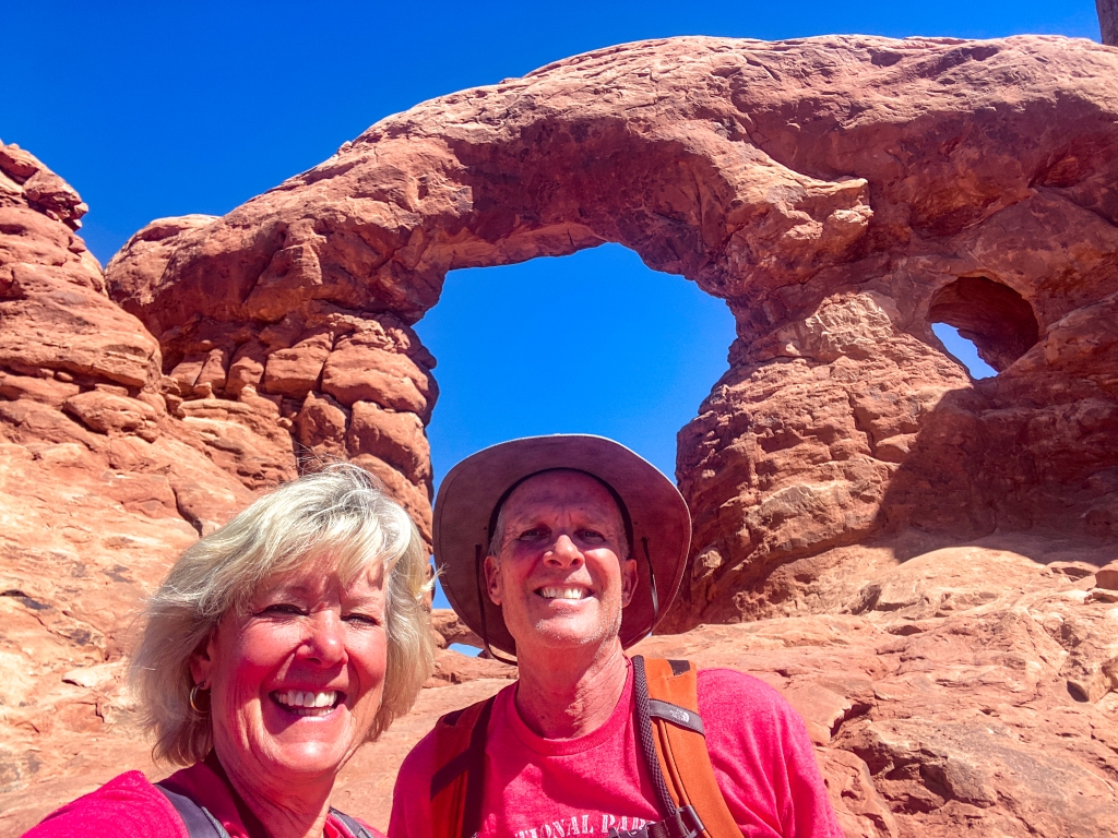
The first hike that we wanted to complete was one that we had done before but 3 years ago I didn’t have the courage to go all the way to the Delicate Arch. This time I was determined I was going to complete this trail and stand under the arch. It’s not a hard hike, mostly climbing uphill on slick rock which wasn’t particularly difficult but it’s straight up at times. I have some pictures below that you can check out and see the tiny people walking up the slick rock. I had to stop several times to catch my breath but there was no difficult scrambling on the hike. Once we got near the top, we had to scramble around some small cliffs but that wasn’t too bad either. I took a selfie of us from the wall of boulders and decided I didn’t really need to go under the arch but once Greg did it and I got a photo of him under the arch, I decided I needed to do it as well! Success!! This is one of the most famous arches in the park and is always crowded but people were great about letting others get under the arch for photographs as if they were the only ones by the arch! This famous arch is also on Utah’s license plates. Arches NP has over 2,000 stone arches but this one is recognized world-wide as the symbol of the state of Utah. It’s the largest free-standing arch in the park!!


The next day we took several smaller hikes to reach more of the arches. We hiked to North and South Window Arches, Double Arch, and Turret Arch. These arches are all together in the Windows Section of the park so the hikes were short and easy to complete. A good time to catch a few selfies. This is a popular section of the park so getting photos without others in them was harder than at other arches. After seeing the two Windows Arches, we took a primitive trail back to the car and it was so nice because we were the only people on the trail. It was quiet and secluded without feeling like we were way far away from civilization.


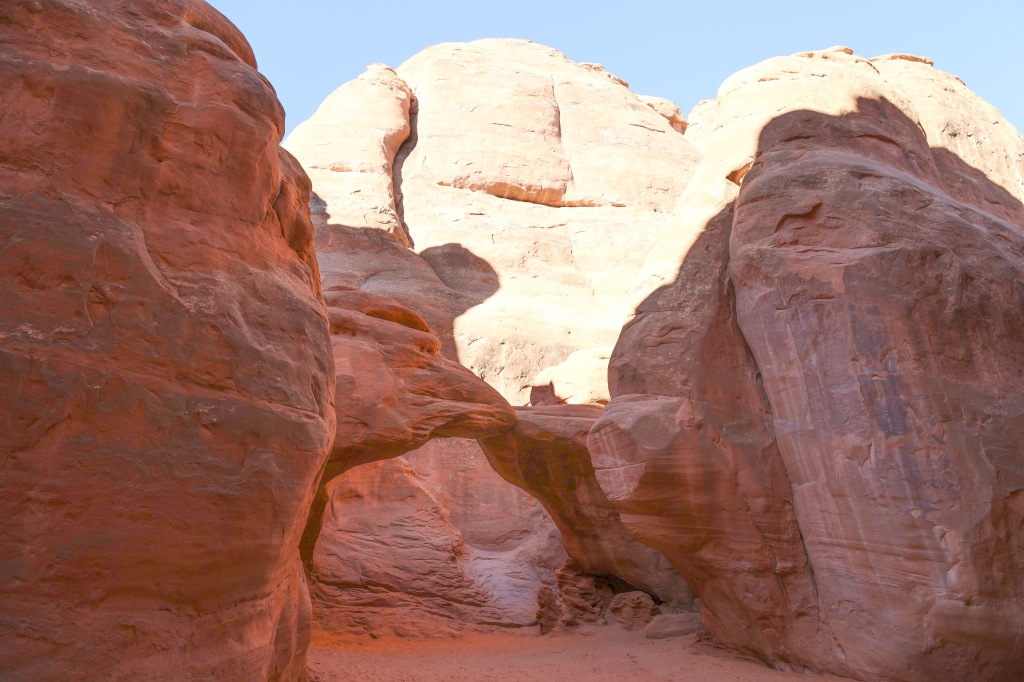
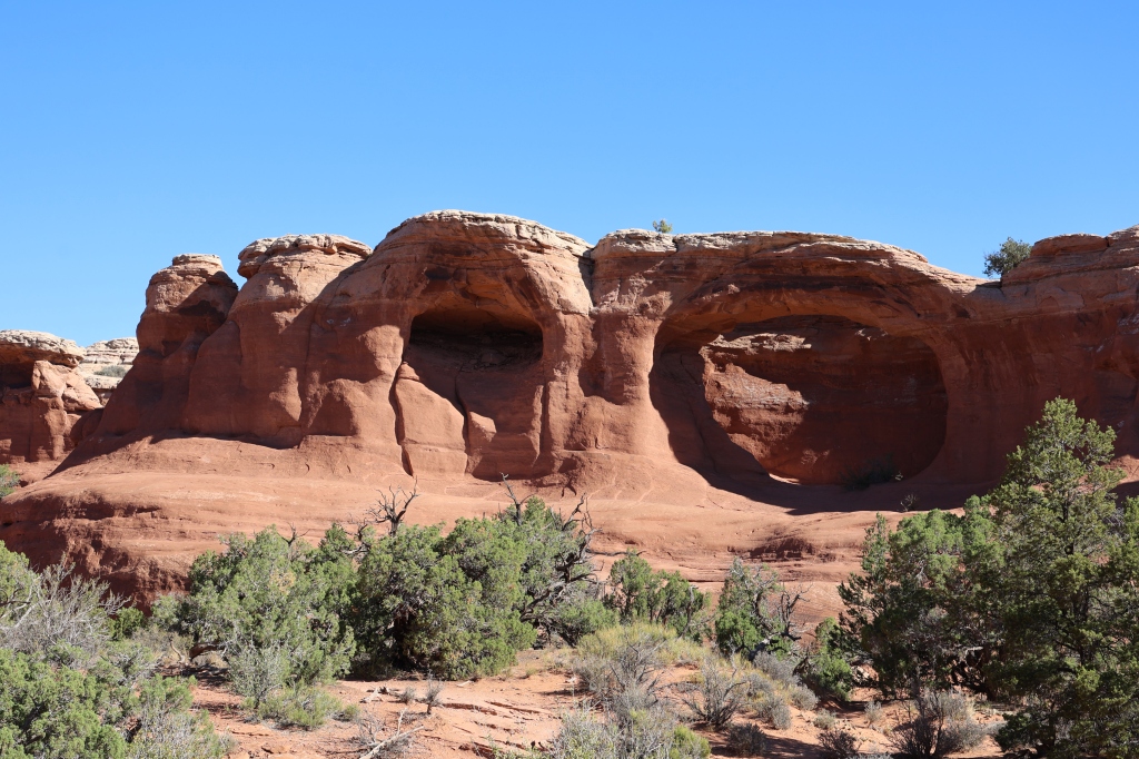
We decided to complete a couple more hikes; Sand Dune Arch, Broken Arch Hike, and Tapestry Arch Hike. These were all fairly short hikes and we were able to complete them all within a couple hours. If I didn’t stop so many times to take pictures we could finish a lot more quickly!! Here are some photos from these hikes.


We decided while we were in that park that we would complete a Jeep trail that I thought we had done in our previous trip and since it was too hot to hike, we gave it a go. Big mistake for me!!


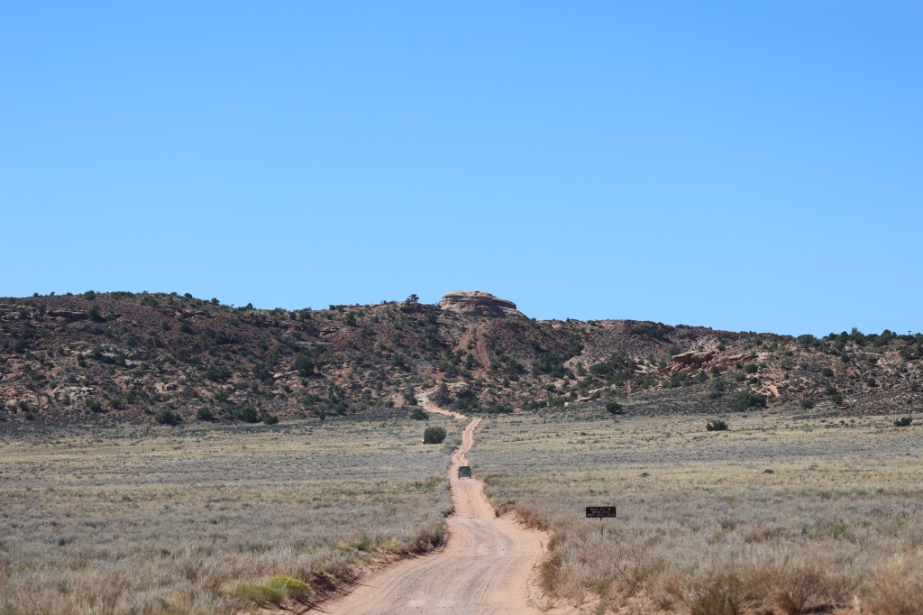


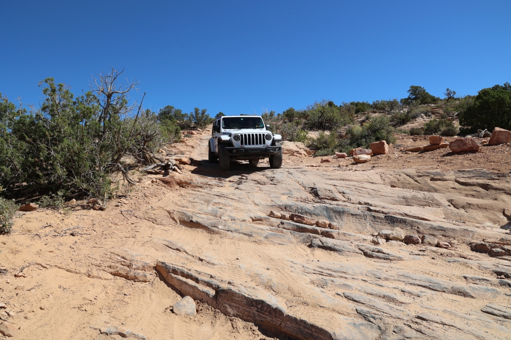


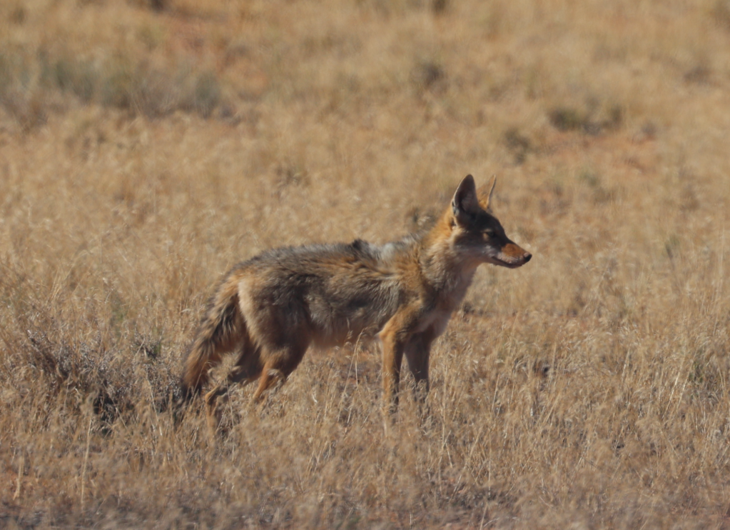
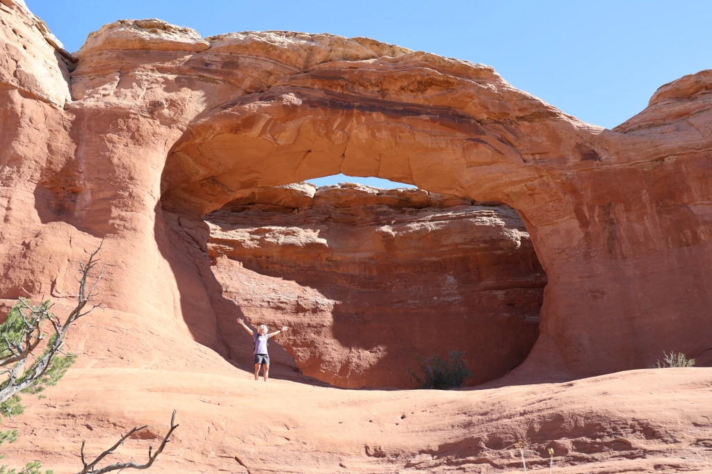
We started on the Salt Valley Road which was mostly soft sand in wash crossings. That’s what I thought the whole road would be WRONG!! We took a turn (and saw a coyote) and went onto a 4 wheel drive road. We passed the entrance to Tower Arch and Marching Men and drove down the Tower Arch Road. The book said it was “beautiful, challenging and great fun”. Not sure I’d agree with the “great fun” part. We found the trail to be harder than on our previous trip. We didn’t know it was rated as a difficult road and that the obstacles at the entrance were tougher than we thought. It took about 3 hours to complete. There were a couple difficult rocky climbs and careful tire placement was needed as well as a spotter (ME). Because we have a tow bar on the front of the Jeep, we had to be especially careful not to damage that on this ride. We had to weave between large boulders at the bottom of the wash and then drive over several rock humps which dropped into a narrow wash at the bottom. I was so happy when the steep rocky scrambling over large boulders was complete!!
One of the sections of the park, Devils Garden, has 6 arches in it that we wanted to tackle hiking. We had completed all of them in our previous trip except one, the Double O Arch Hike. I was determined I would complete all 6 this time, so that was the next day’s plan!


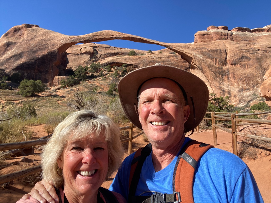
Devils Garden Trail is the longest of the maintained trails in the par k. The length of the trail is 6 miles; 7.2 if you choose to do the primitive trail on the return Loop. If you don’t do the primitive loop you would just return the same way you went out. That means you scramble down the rocks just as you scrambled up them. The trail to Landscape Arch is easy and well-graded and it gives you a close look at one of the longest natural stone spans in the world. There are two short side trips to Tunnel and Pine Tree Arches which we completed as well. The trail between Landscape Arch and Double O Arch is more difficult, winding along narrow tops of exposed sandstone fins, then up and down steep crevices where steps have been cut into the rocks. It said this trail wasn’t recommended for hikers with a fear of heights (ME), but I was determined to complete it anyway!


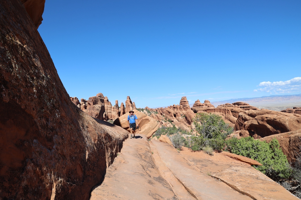

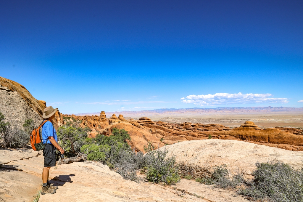


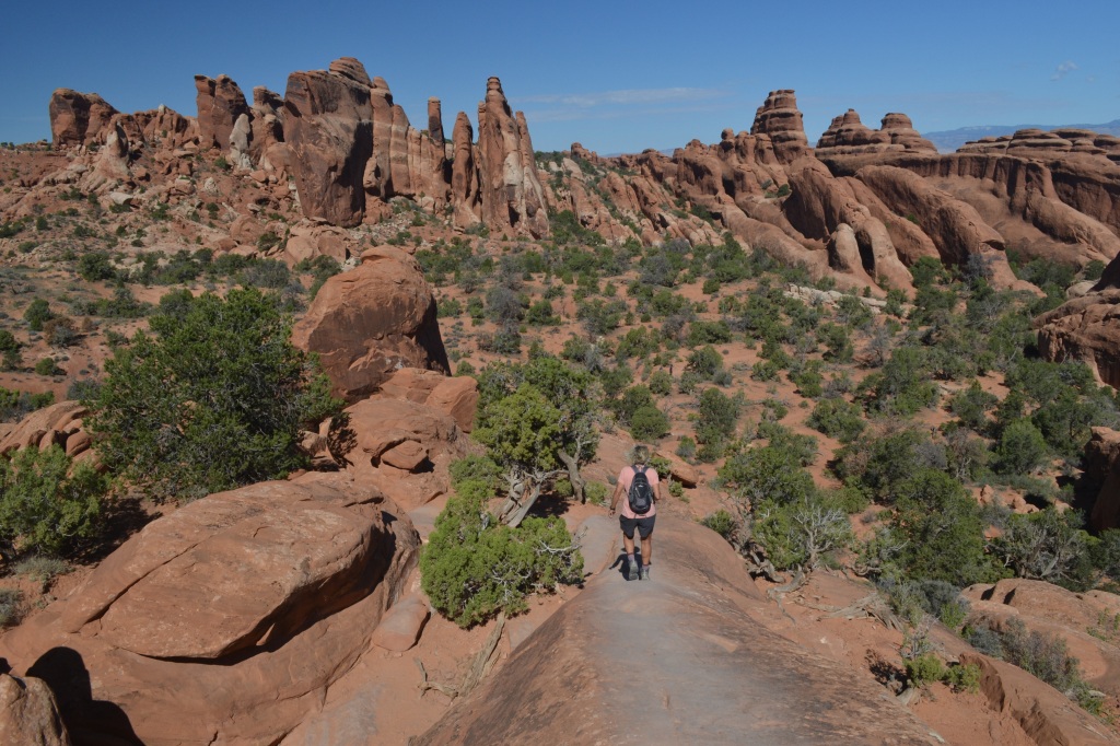
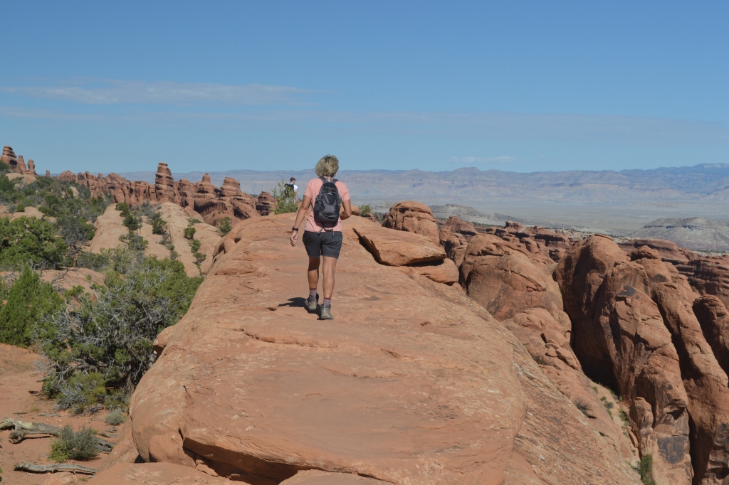
Proof I made it to the top and scrambled along with Greg. Now I can check that one off of my list! One more day of hiking and I’ll post that day tomorrow.
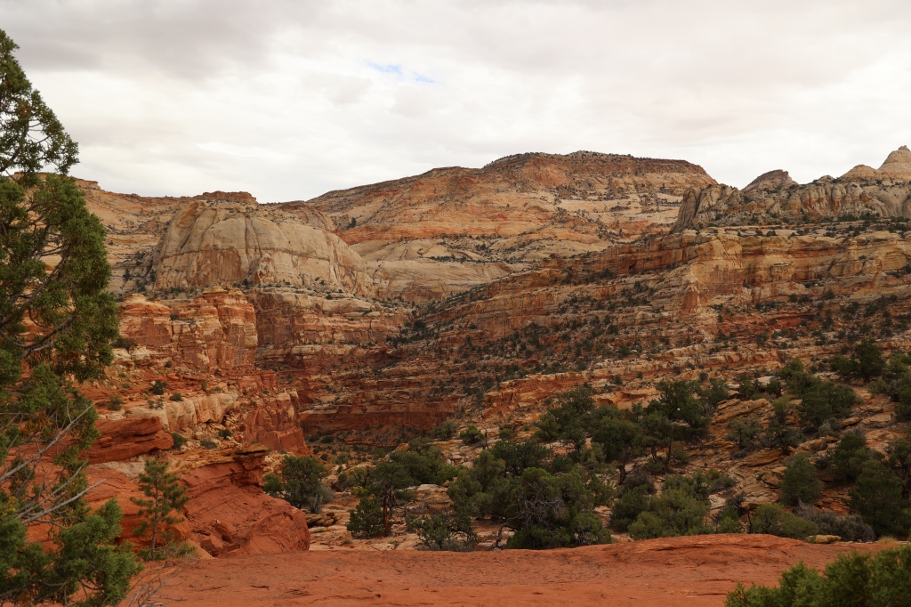
Today marks 2 months on the road, 17 different campgrounds/resorts, and a little over 4,400 miles have been covered. We’ll be in Moab, Utah for a week to explore Arches National Park and take in some Jeep trails! Wednesday when we were still at Capitol Reef NP, it rained the entire day; which I guess is pretty unusual for that area. The rivers flooded, the park was closed the next day, and all of the spur roads off the main roads were closed as well. Luckily for us, the hikes we wanted to complete were off highway 24 and not in the park.
We went on the Cohab Canyon Hike which started at the Fruita Village. Fruita is an historic town that is well known for its orchards. Now it’s used by the park to educate and attract tourists with its museum-quality exhibits from the pioneer era. The hardest part of the hike was climbing up the steep side of the Waterpocket Fold and into the mouth of Cohab. It climbs to the upper base of the canyon about a half mile away and about 400 feet above Fruita. After climbing to the top you’ll find yourself in the walls of the Cohab Canyon which slopes down to Highway 24. Once you’re in the saddle part of the canyon where it’s open, you’ll find other connecting trails. This part of the canyon is very colorful and easy hiking compared to the climb up in the beginning. We stayed on this trail til the end at Highway 24 and then jumped onto the Hickman Bridge Trail. Some people prefer to hike the Hickman Bridge Trail as a separate hike. If you do that, you can park at the trailhead on Highway 24 and skip the Cohab Hike. Cohab was 1.7 miles one way and strenuous at times and pretty easy at others. The Hickman Hike is only about a mile one way but then you have to walk back and then take Cohab back to the car for a total of almost 6 miles. A good hike combines the two trails! Both trails were clearly marked with moderate elevation gain; strenuous at times and moderate at others.


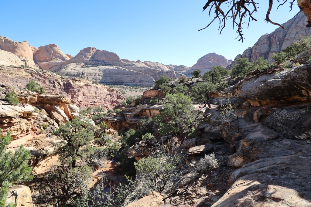


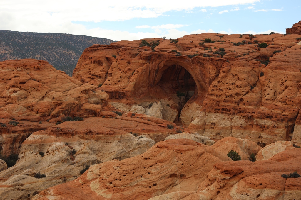
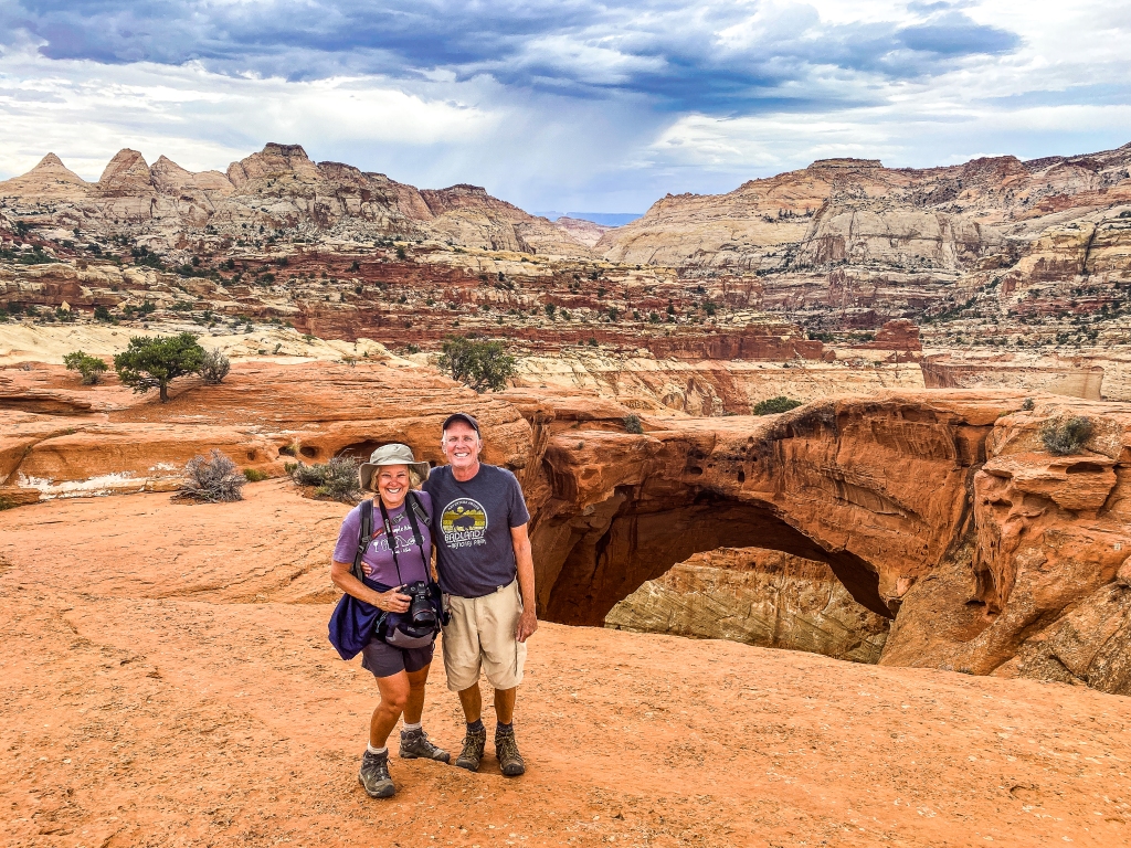
Once we finished the Cohab Trail we crossed over Highway 24 to complete the Hickman Natural Bridge Trail. Once again we found ourselves with a strenuous climb up to the bridge but coming down was a breeze! This is one of the most popular trails in the park and we didn’t know it at the time, but the actual Scenic Road in the park was closed and since this trail was off Highway 24, it was more crowded than normal. But it was still manageable. Hickman Bridge is one of the better knows sites of Capitol Reef and this natural bridge sits 300 feet above the Fremont River and Highway 24 and it’s still below the heights of the surrounding Waterpocket Fold. The trail passes underneath the arch and then heads south to the base of the hill and down to the river. The sky was clear and the hike was beautiful and the views were stunning.

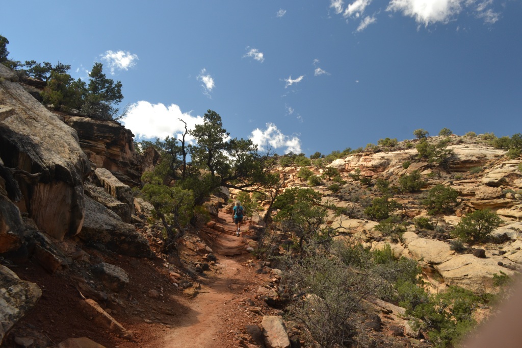


After a quick lunch we decided to try one more hike, the Chimney Rock Hike which initially climbs steeply alongside a fault that has split and offset the rock layers of the cliff in front of the start of the hike. Once you get at the top of the bluff, you’re rewarded with a great view of Chimney Rock, which is a part of the western Waterpocket Fold. The colors of the rock were beautiful and I kept snapping pictures of the rocks all around me. We didn’t do the entire hike as it was getting late and we had already done several hikes that day. It was definitely easier coming down than the initial climb up!!


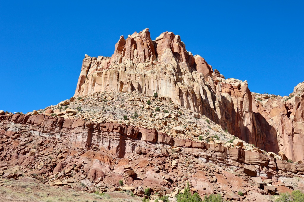
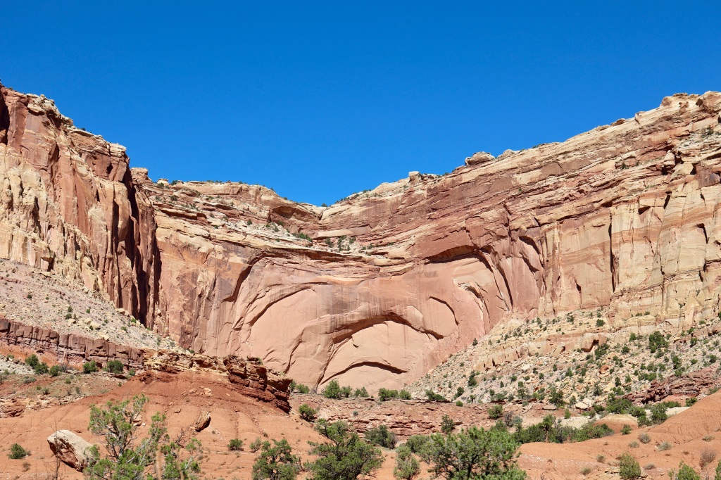
We needed one more day here (we lost a day due to the rain/flooding) and we would have seen everything we had planned for the trip. Here are a few more random photos. Capitol Reef isn’t visited by as many people as some of the other parks but WE LOVED IT.


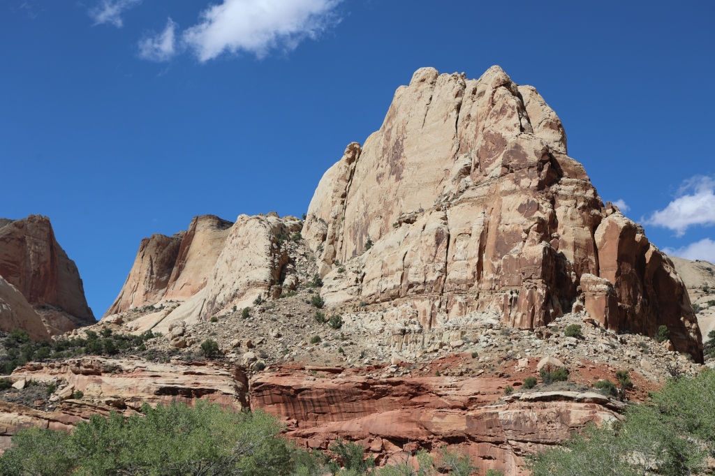


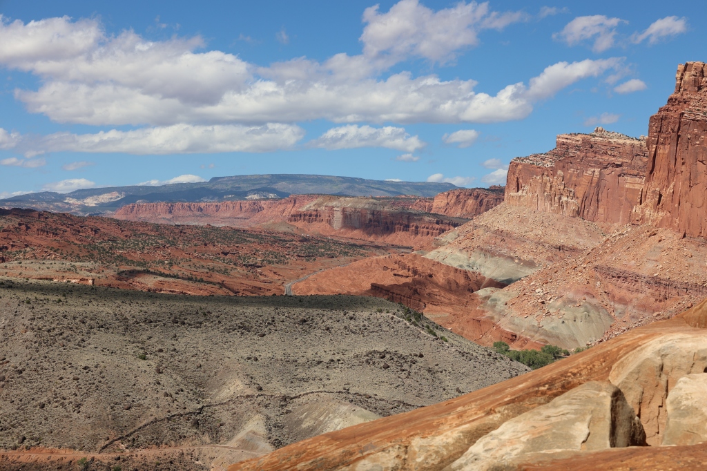
The last photo shows the “capitol” for which the park is named. It resembles the Capitol building in Washington, DC. A reef is something that impedes travel and this area definitely impeded the early pioneers’ travel with the sharp cliffs, valleys, and visible obstacles of the park. Truly one of the most beautiful parks we’ve visited!
The Waterpocket Fold is Capitol Reef’s centerpiece. This 100 mile long wrinkle, or monocline, tells the story of slow changes over vast amounts of time. The Scenic Drive is pretty amazing as you can tell by the photos from yesterday’s post, but today we traveled down highway 24 and onto the Notom Road for some additional views that were spectacular. Once we were on the Notom-Bullfrog Road for a bit, we turned left onto the Old Notom Road which was a dirt road with beautiful views. This road put us back on highway 24 further east and we traveled west then to get back near the Visitor’s Center of the park. Here are some photos from the Notom-Bullfrog Road and Old Notom Road.


While driving back to the park area, we passed the Behunin Cabin on highway 24. This cabin is in the Fruita District near the Visitor’s Center. While driving back to the park area, we passed the Behunin Cabin on highway 24. The Behunins were two of the early settlers to file a homestead claim around the Fremont River. He and his family built this cabin in 1883 and only lived there for a year because it was not an easy place to homestead. His family of 15 lived in this small house and the older boys slept in a sandstone alcove and the older girls slept in a covered wagon box. The crops were washed out by floods and the house was too small for the family. They moved east for a while and then back to the Capitol Reef area and the youngest daughter began teaching her younger siblings. The community worked together to build a one-room schoolhouse which you can see below. After about 10 years Elijah and his family went east again.


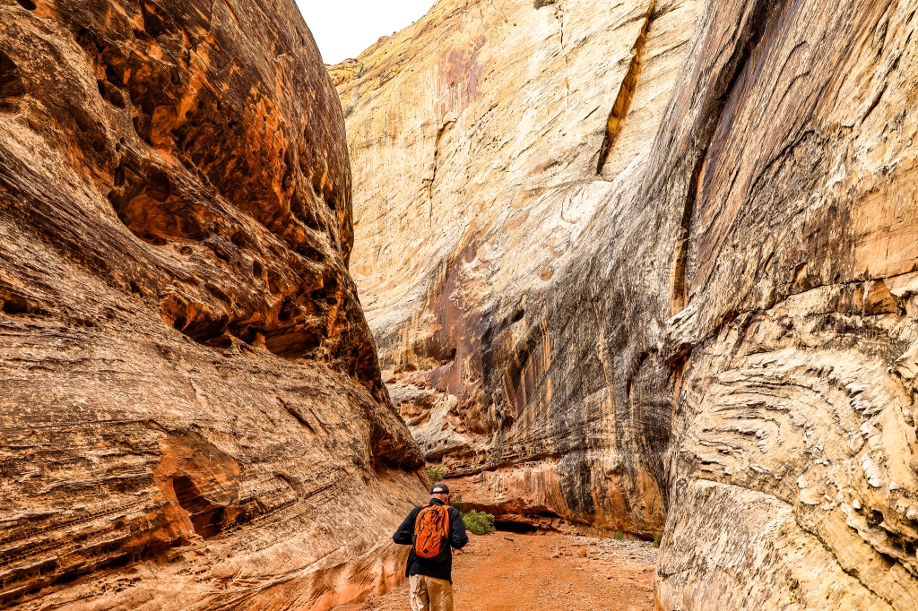
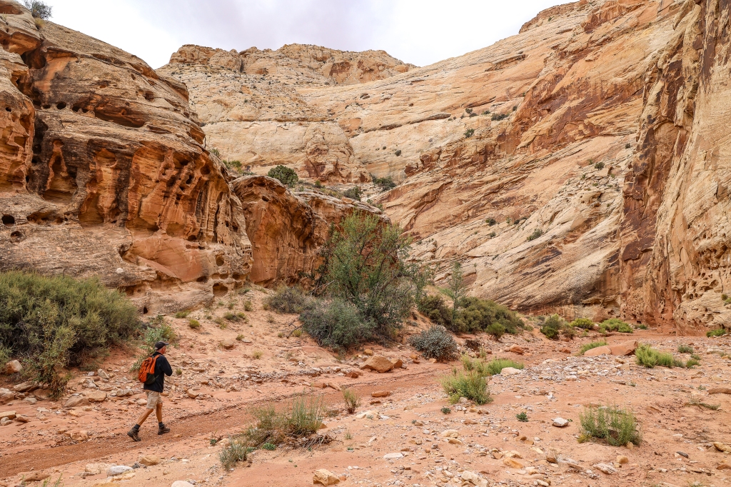
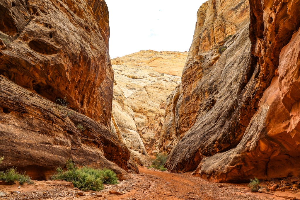
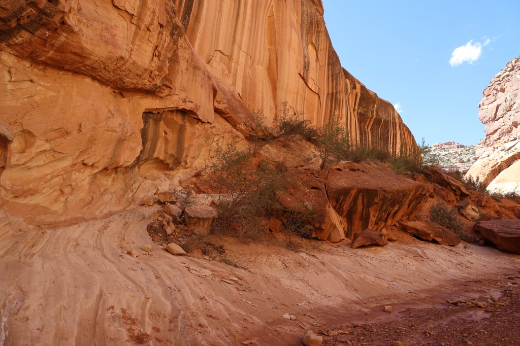
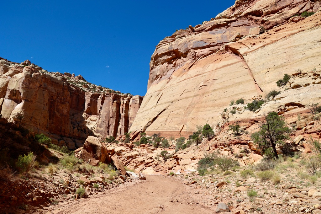
On our way back toward the Scenic Drive we saw cars parked by the Grand Wash and decided to try out the hike. We had already walked the other end of the Grand Wash which can usually be driven on but was being repaired. At about the center of the two entrances is a toilet and access to the Cassidy Arch Hike which we wanted to try. We walked along the wash to the beginning of the Cassidy Arch Hike and had a little difficulty finding the sign showing us where the hike begins but once we saw it, we couldn’t believe we hadn’t noticed it previously. The Grand Wash follows the wash and is an easy 2 mile walk along the canyon floor. At about 1.3 miles into the wash we walked through the Narrows. There weren’t any slot canyons, just a more narrow walkway and then we reached the entrance to the Cassidy Hike about .2 of a mile from the toilet. The hike was beautiful and we were watchful for storms as it was a cloudy day and back in June, six pickup trucks got pushed down the wash following a flash flood. The stream bed is typically dry as it was today and we walked along the rocky, sculpted heart of Capitol Reef. We noticed our footsteps echoing between the sandstone cliffs that were hundreds of feet above us. I tried to capture photos of Greg walking through the wash to show the size of the cliffs.


Once we found the beginning of the Cassidy Arch Hike, we began our 1.5 mile hike to the top. The first part of the hike is the most challenging part of it. There’s a series of tight switchbacks as you climb out of the canyon floor and up into the colorful hills. It’s only a little over a quarter of a mile in this section but my heart rate was up there as I pushed myself to climb the rocky stairs that seemed to be imbedded into the side of the hill. The arch was named for Butch Cassidy who was a bank robber and the leader of the group of outlaws know as the “Wild Bunch”. This area was known to be one of his many hideouts. Once we got to the top we could either view it from a distance or walk across it for a unique photo opp. I have a fear of heights but I had made it this far and thought I could make it to the top of the arch! Luckily there were cairns to help show the way because there was no obvious trail along the slickrock.


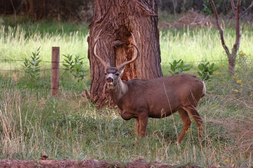
We retraced our steps on the hike (wasn’t a loop) and scrambled back down the hike to return to the Grand Wash. Going down was MUCH easier than going up!! If we had wanted to continue the hike, it connects to Frying Pan hike but would have added more length to our hike and would have put us out at a different place than where we started. We completed the hike down to the wash and back to the Jeep for a total of 8 miles! Not a bad hike for some old people!! One of my favorite hikes I’ve ever done. Rewarding views (as you can tell by the numerous photos I took). No day would be complete without animal photos. We saw two bucks on our way back to camp. Rain tomorrow so we will catch up on miscellaneous tasks. More hikes and dirt roads Thursday and then off to Moab and Arches.

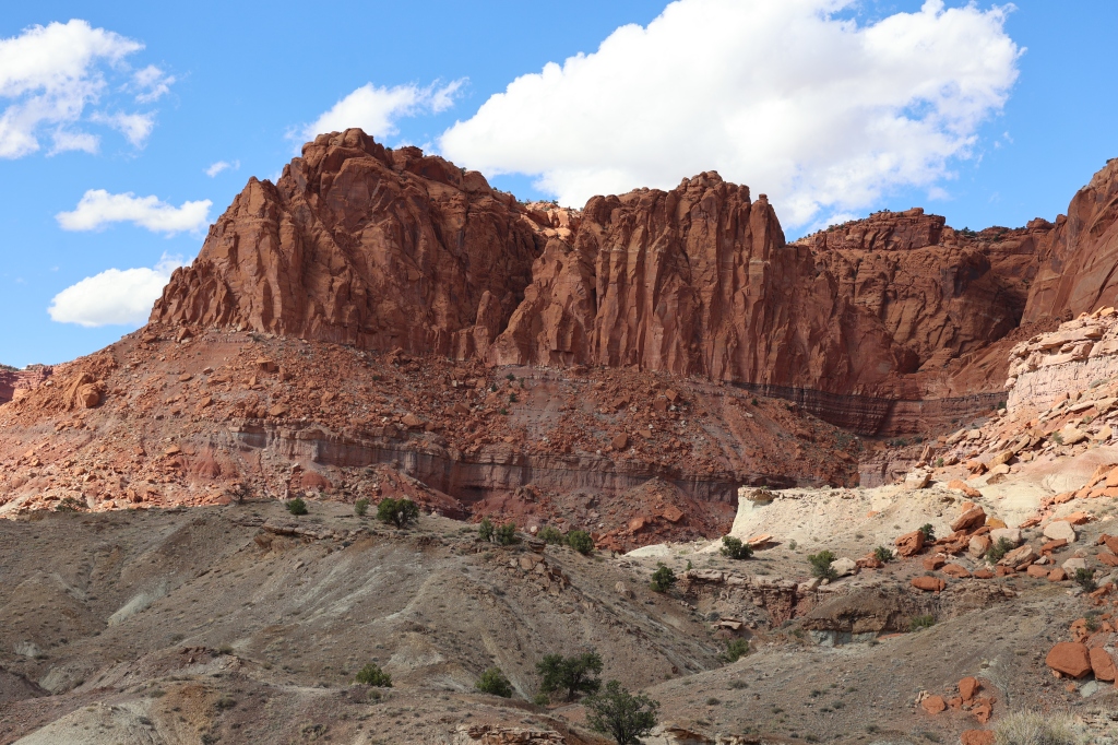
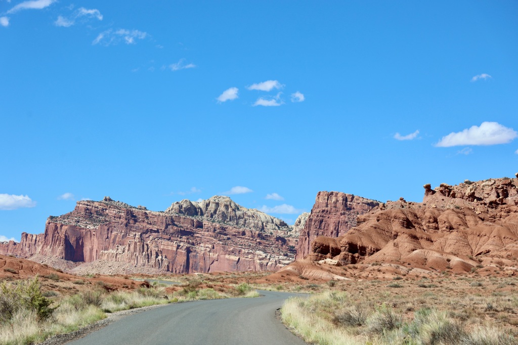
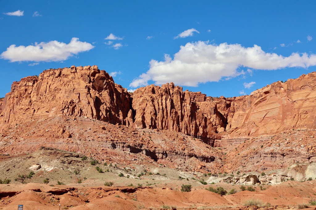
Capitol Reef was created by the Waterpocket Fold, an almost 100-mile long wrinkle in the Earth’s crust. The two most popular areas in the park are The Fruita area and the Scenic Drive. There are lots of hikes and a well-developed campground can be found in the park. Part of the park is characterized by broad high-desert valleys and massive monoliths sculpted by erosion. We did the Scenic Drive today to get a feel for where things were located within the park. At The Fruita area at the beginning of the Scenic Drive there is a beautiful historic barn, house and smokehouse built by an early settler. It’s a beautiful barn referred to as The Pendleton Barn and in 1969 the barn was sold to the National Park Service and the farming community of Fruita ceased to exist.


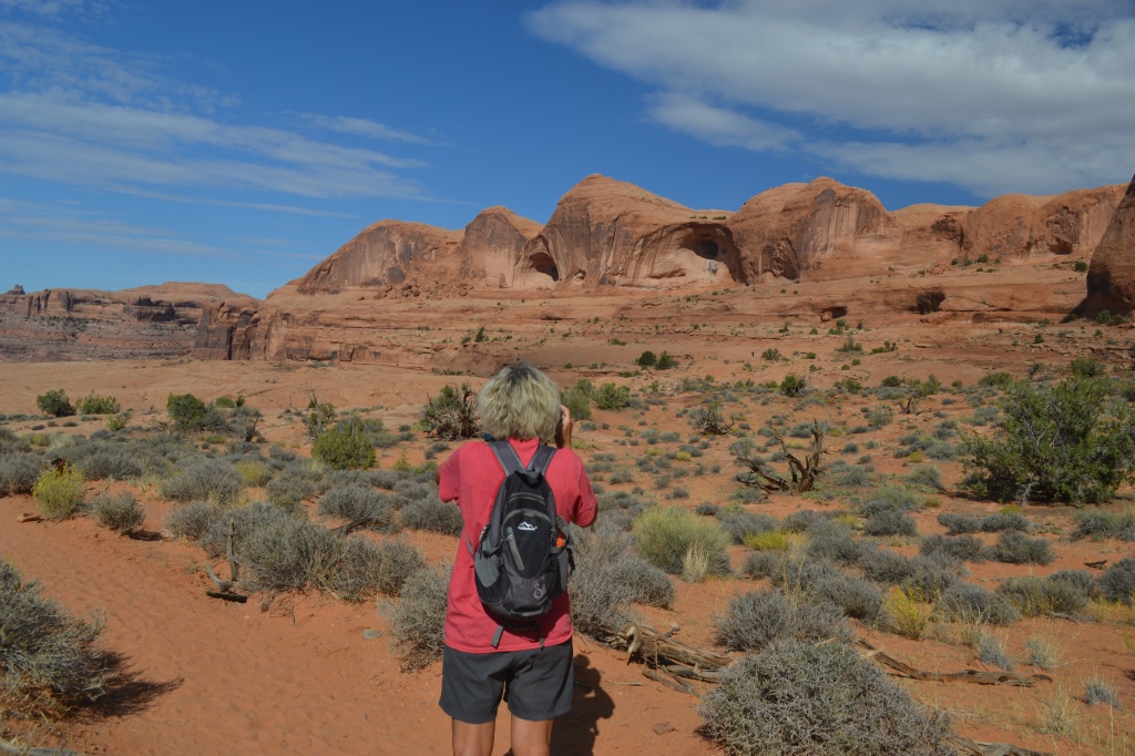
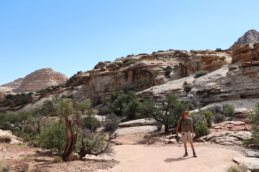
We can’t wait to explore the park tomorrow. The drive showed us there are lots of hidden treasures-cliffs, canyons, domes, and bridges! Three powerful geological forces caused this area to be formed over time: deposition, uplift, and erosion. As a result of these forces; a monocline, or one-sided fold, is formed in the otherwise horizontal rock layers. We were amazed at the beautiful colors within the rocks and the sheer size of them! Find me in this photo and you’ll see what I mean!

The Waterpocket Fold creates the geologic features that gave Capitol Reef its name. Capitol for the rock formation near Hickman Bridge that looks like the dome of the US Capitol and reef for the rocky cliffs that reminded early European American travelers of ocean reefs that created hazards for ships at sea.

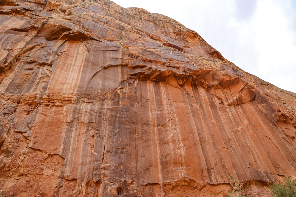
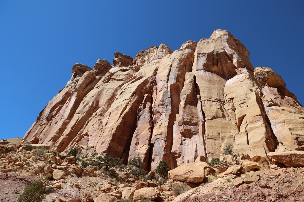
After we completed the 7.9 mile Scenic Drive (which isn’t a loop) we wanted to drive down the dirt road at the end of the Scenic Drive (Capitol Gorge) into the gorge, but because of recent rainfalls, the road was blocked but we were able to walk about 1.5 miles down through the gorge on the dirt road. We passed one area of rock called the Tapestry Wall and the sunlight was going over the top of the “wall” making it really pretty! The colors of the wall and the way it was “folded” really did look like a tapestry. The ranger said they may scrape the road with a bulldozer later today to clear out the washed out areas so hopefully we can drive down the road another day. It was a pretty walk as the gorge narrowed and you could almost imagine the water rushing down through the gorge to form the layers.


We were also able to access another dirt road called South Draw which had just been scraped! It took us through a couple more miles of the park and across a small river. Once we crossed the river we decided to turn around as the road was extremely rough and unmaintained and even with a Jeep, the going was tough. There were remnants of a small farming community along the road which was pretty cool looking!


We didn’t plan on completing any hikes today but once in a while we pulled over and took a little walk around on the sandstone in preparation for tomorrow’s hikes!! Here are a few photos from some of our walks along the scenic drive.


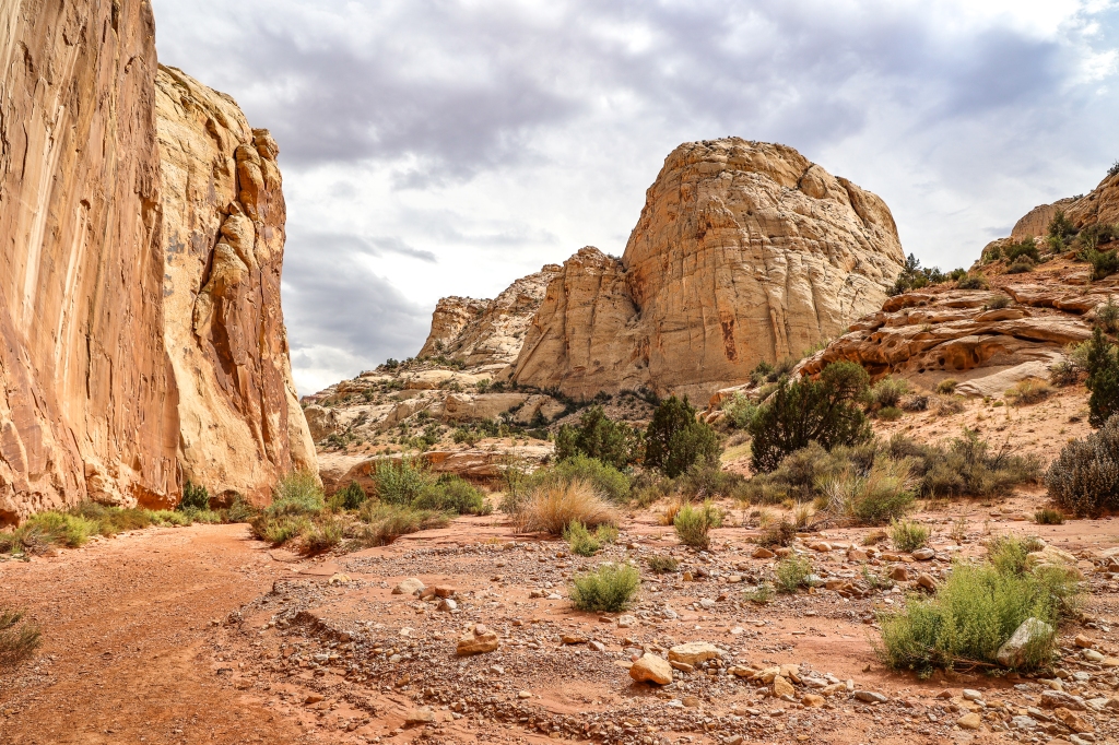
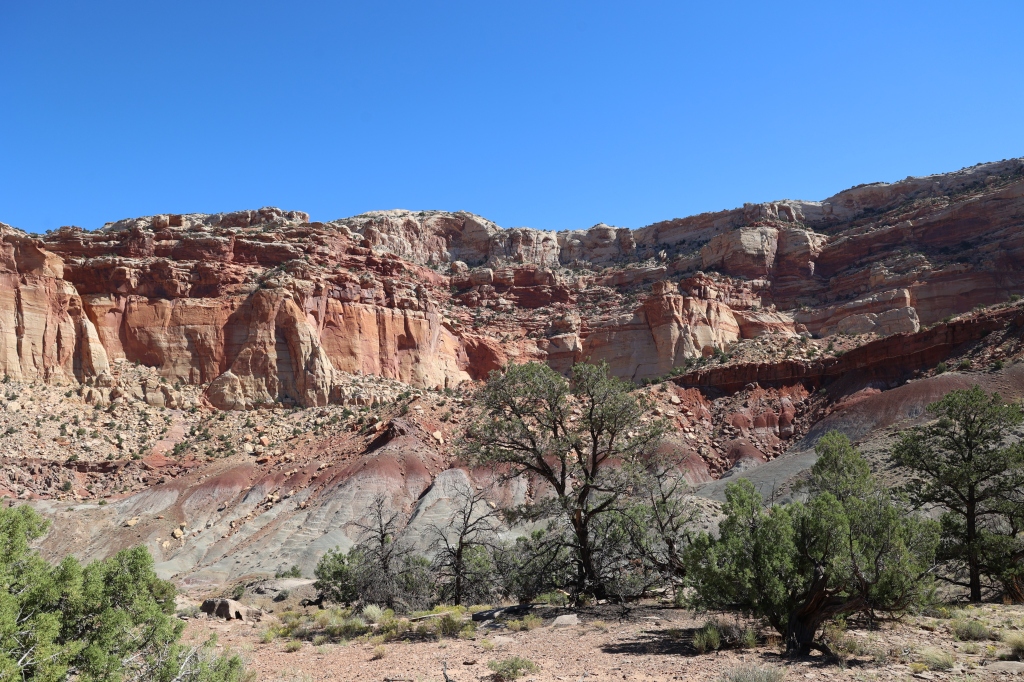
The Scenic Drive is 7.9 miles but if you stop often like we did for me to take photographs, the drive will take longer than normal. Most of the rock at Capitol Reef is sedimentary, formed in layers from loose materials. The rock bands show differing thickness, colors, and textures and they lay on each other like layers on a cake. The overlying sedimentary rock layers folded into a one-sided slope called a monocline. We will be able to see more of that tomorrow. On the west side of the park is the Waterpocket Fold named that because of the numerous small potholes or pockets that hold rainwater and snowmelt.


And now proof that we were there! Hiking tomorrow.


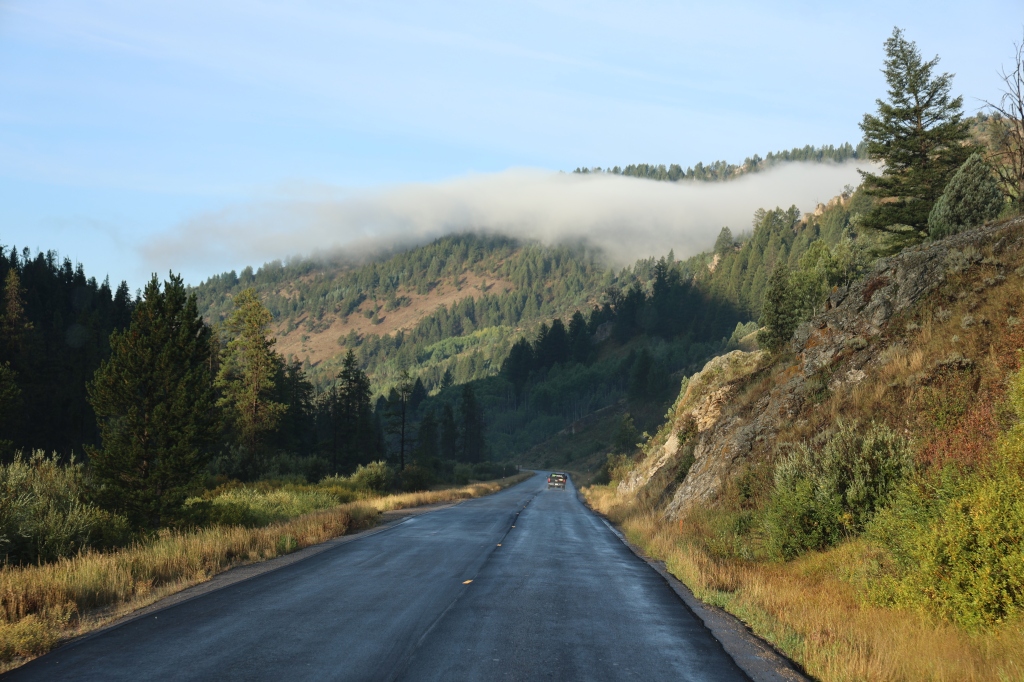
We spent our last couple of days in GTNP hiking and driving down every dirt road we could find and we loved every minute! The only negative thing about the trip was having to cross the Teton Pass every morning and again every evening. That made the trip to the park take about an hour each day not to mention the stress of the mountain pass! We stayed in Victor, Idaho at the Teton Valley Resort and the campground was very nice but a little pricey as was everything else in the Jackson Hole area. Today we drove to Capitol Reef National Park and we will visit the park tomorrow. The best part of RV travel is watching the changing landscape as we travel. Here are a few shots from the dashboard during our 10 hour drive today.


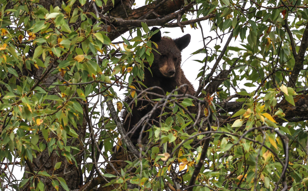
After being at the GTNP for a week, we began to learn the area and where the animals liked to hang out best. Of course it didn’t hurt that we stopped each time we saw a crowd by the side of the road. That made it easy to deduce that an animal was nearby! We learned that Oxbow Bend, Moose-Wilson Road, Schwabacher Landing, and the Gros Ventre Campground were great places to see a bear or moose. We saw them at each of those places except for The Landing, but I still loved visiting that area for its beauty. Here are a few moose, bear, and buck photos from those places. Some days we would go early, other times at noon, and other times in the evening. We had good luck most times that we were there. The animals seemed to really gravitate to those particular areas.
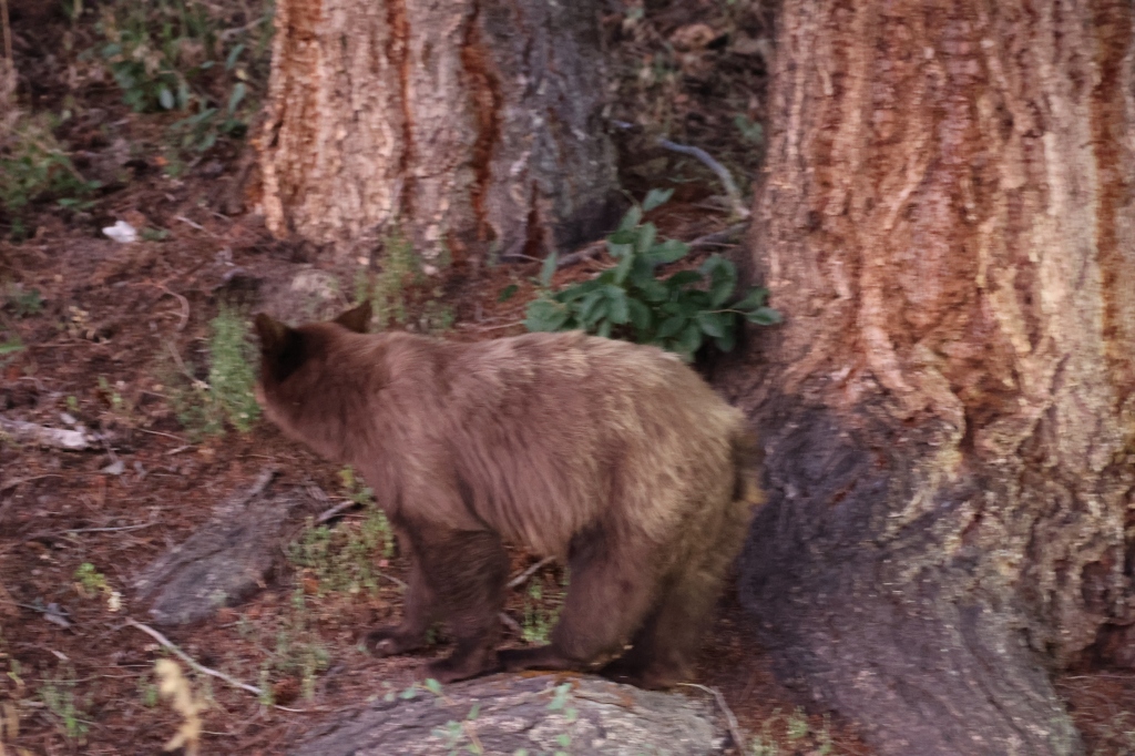
Here are two different black bears that we saw at the overlook on the Moose-Wilson Road two different days.


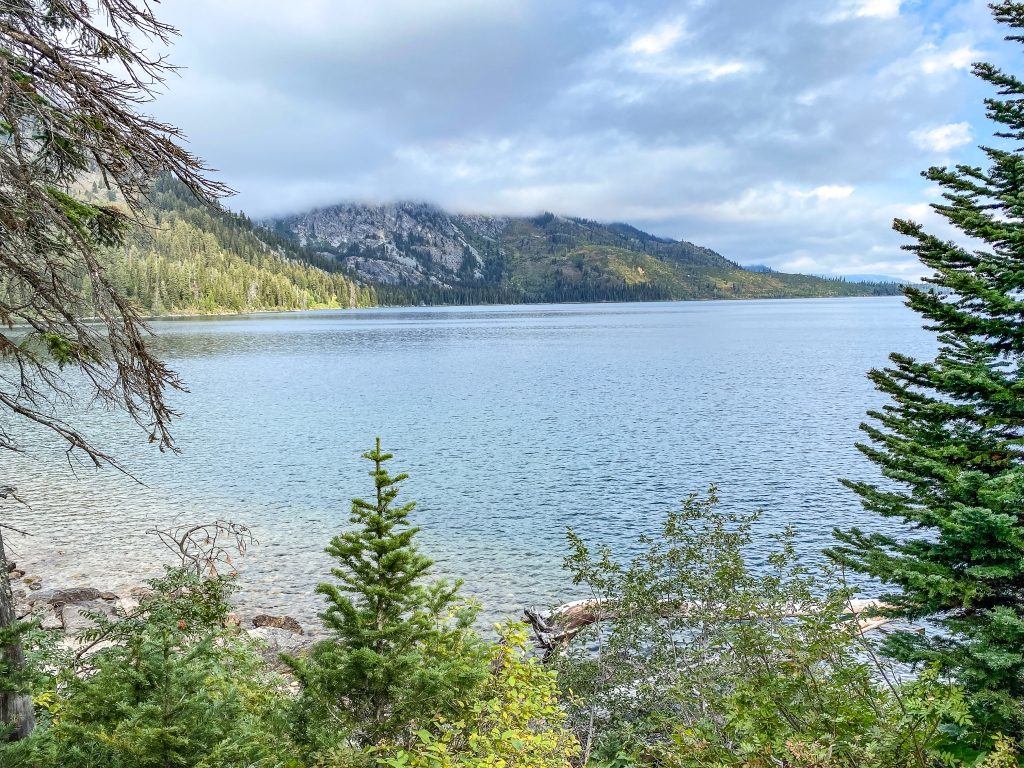
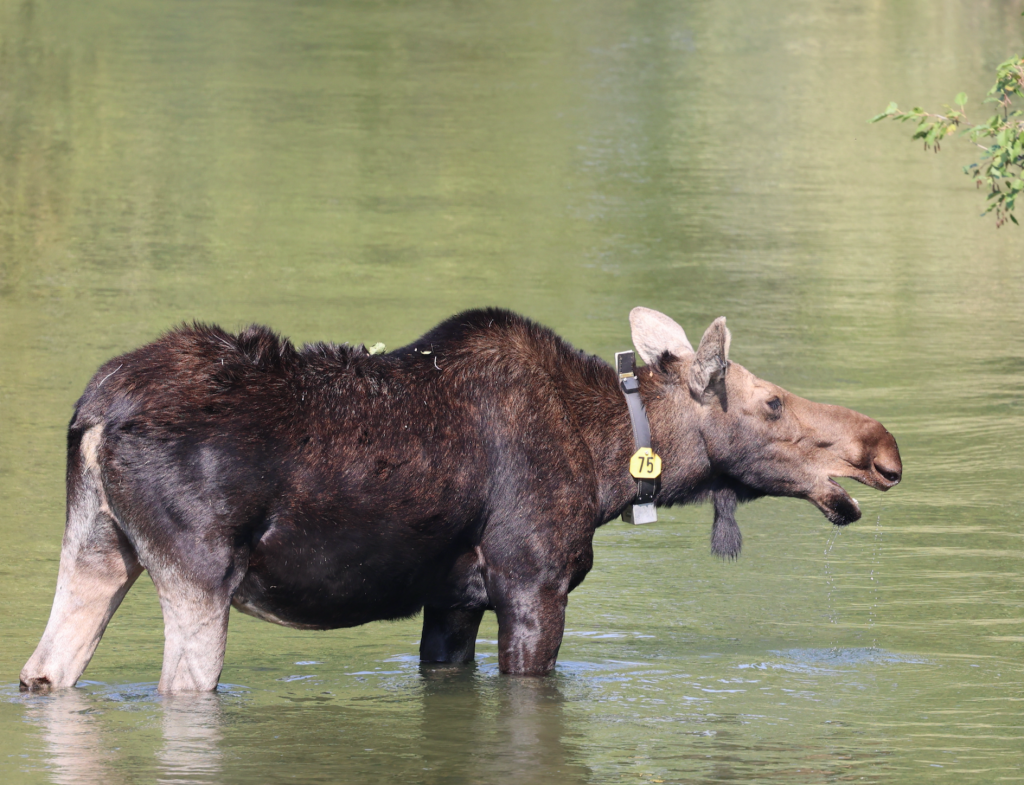
Lots of moose were seen in the Jenny Lake area. Some by the bridge as you enter the area, some in the pond at Moose-Wilson Road overlook and some at moose pond.


We were also able to see a buck with the velvet being brushed off from rubbing against trees. Male deer have two soft spots on their skulls. During the spring, there pedicles grow two little stubs of bone wrapped in sensitive skin called velvet. The velvet around the antlers provides blood and oxygen that the antlers need to fully mature. During the fall they rub the velvet off and in the spring they will grow a whole new set of antlers.


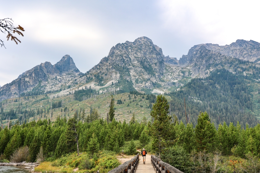
We hiked around Jenny Lake on a previous day and made it up to Cascade Canyon and discovered our first moose. So, we decided to try the hike again but we weren’t able to find any moose but the hike was beautiful and I wasn’t nearly as frightened heading up Inspiration Point. Here are a few shots from the hike. We took the shuttle back across the lake and saved 2.4 miles of hiking!


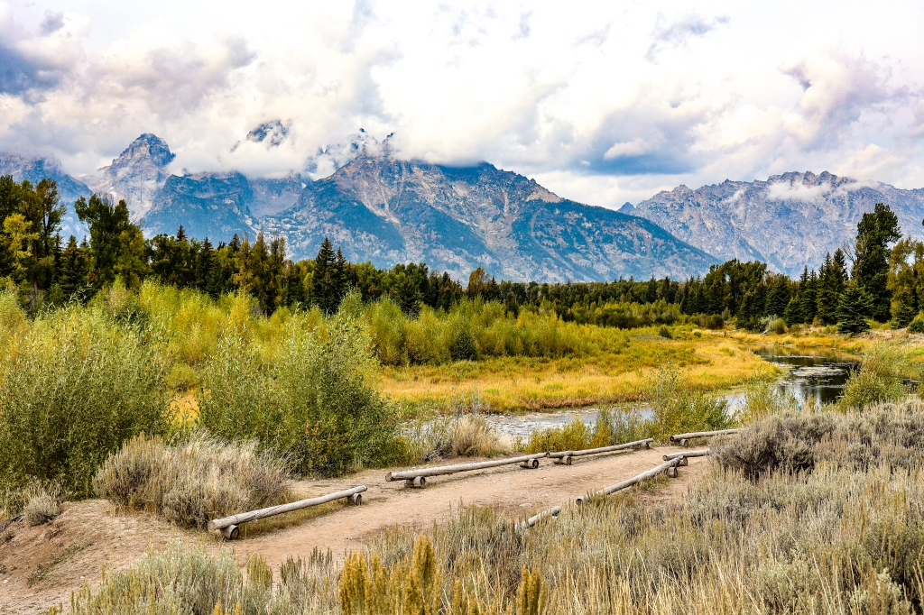
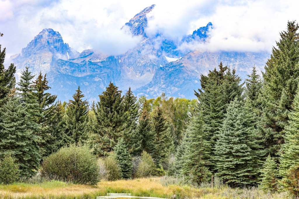
The sky was hazy from fires in Idaho and the weather was cool and rainy for our last few days of the visit. Each day was beautiful whether there was blue sky or cloudy/rainy days; we made the best of every day. The light on the mountains and valleys was beautiful and so different at the different times of the day. Here are a few shots from our last few days.


On one of the rainy days we took a drive behind Elk Refuge on Refuge Road. We drove for miles on a dirt road to the top of a mountain in search of wildlife. NOTHING!! The views of the valley were beautiful but we were disappointed that we didn’t find any wildlife because it seemed to be the perfect environment for wildlife. Here are a few shots from that ride.


Good night Grand Tetons National Park…we’re off to find some more exciting hikes and adventures.


Yesterday we woke up early to begin our 6:30 safari day in which we hoped to see a bear, moose, and maybe elk (actually we were excited about seeing wildlife in general and being outside). We opted for a full day outing with the Jackson Hole Wildlife Safari company and we had an excellent guide who was familiar with the area and was a true lover of the park, wildlife, and nature in general. We toured areas we had already seen and some new ones were discovered. It was a mix of special areas within the park that are known for wildlife sightings as well as some favorite haunts of the guide that have proven to be good wildlife areas. The guide’s stories and information about the area and animals proved to be plentiful and much new information was learned about the Grand Teton NP in general.
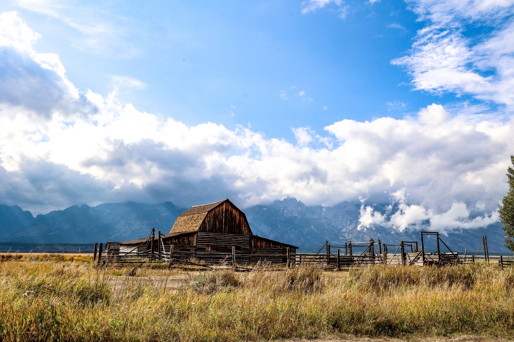
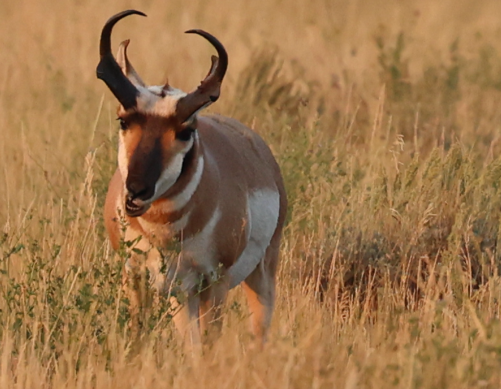
We started our day with a visit down Gros Ventre Road and there we saw pronghorn, bison, and the iconic Mormon Row barns. The light was perfect for photographing the barn that we visited and the animals were visible in that area. We also saw a moose through a spotting scope but it was too small to photograph well. Was a great start to an exciting day. The difference in lighting from one side of the road to the other was amazing.


Next we ventured into the park at the northern entrance to check out Oxbow Bend since it was still early. We saw lots of cars along the road as we approached the area and were fortunate enough to see Grizzly 399 eating some berries along the side of the road. The rangers were there monitoring traffic and preventing people from getting too close but I was able to get a few good shots of her. She became famous about a decade ago after she became one of the first grizzlies to frequent roadsides in the GTNP. More grizzlies are sighted in Yellowstone so to see her in the Tetons was a real treat! At age 26 she is one of the oldest grizzlies in the Teton/Yellowstone Ecosystem. It’s unusual for grizzlies to have more than two cubs and in 2020, 399 had four! The question everyone has is will she have more cubs next year?? They typically live 20-30 years in the wild and they often die because their teeth wear out and they can’t eat. Her teeth (according to rangers not my own observations) are in fairly good condition. We watched her eat berries from a distance and then watched her swim across the lake onto the island.


We went to the Colter Bay Area and Jackson Lake Lodge along the Teton Park Road and then went to the Willow Flats area to check out the wildlife and scenic viewing opportunities. The view across Jackson Lake toward the Teton Range is stunning! The wildfires in the area made the sky quite hazy but the mountains were still beautiful as they rose abruptly from the valley floor. In most mountains, foothills obscure the view of mountains, but as a result of earthquakes in the area, these mountains have been pushed skyward as the valley floor hinges down making for stunning views of the mountains.


We had lunch at String Lake, checked out the Lupine Meadows and Wilson Ranch Road and then headed back to the Moose entrance to begin our travels back home. While leaving the Jenny Lake area, we were fortunate enough to see a mama moose and her baby in the Snake River as we were crossing over the bridge. A few shots of them and our day was complete. Seeing 399, the many wildlife animals and especially moose made for a perfect day on safari! We saw a black bear eating berries in the bushes and saw “evidence” of where she had been along a trail but I couldn’t get a good photograph of her. There’s always tomorrow!


Our guide, Amethyst was wonderful! She knew so much about the area and the animals and had a true love of nature/wildlife in general. I highly recommend this full day trip to explore the area. Every day is different with what you might see along the road/trails. The sunlight on the mountains and valleys is different as well depending on the time of day; and the beauty of it all is that it’s amazing no matter how many times you frequent the same place. Til tomorrow!!
We left Yellowstone National Park a few days ago and arrived at Victor, Idaho for our 10 days at Grand Tetons. Our RV Resort is nice and they even have a restaurant we can dine in but we quickly found out that EVERYONE leaves the park at about the same time and our best bet was to stay in Jackson, WY for dinner and then head back to the Motorcoach. The Granite Canyon Entrance Station is the closest to us but it’s closed for construction so we have to enter at the Moose Junction each time. That entrance is about an hour from Victor and going and coming we have to cross the Teton Pass each day. At 8,431 feet above sea level, it’s a high mountain pass with about 10 miles of it causing white knuckling for me. The grade on the road at its steepest is a 10% grade (5 miles up the mountain and then 5 down into Jackson). There is a 1,500 elevation gain on the 10 miles, topping out at around 8,400 feet above sea level before driving the 5 miles back down the pass. There is a section on the road where there is a catchnet system designed to catch vehicles if their brakes fail. Was kinda scary seeing that!!


There are fires nearby in Idaho and Yellowstone so most days there’s a haze in the sky. We’ve learned that the skies are best between 9-3:00 so we try to make sure we’re out and about taking photos at this time. Jenny Lake is one of the favorite areas in the park and the first major one you come to so we spent our first day here. We started out with the intention of hiking around the lake which is about 7 miles, but I was talked into taking a side hike to Inspiration Point, Hidden Falls, and then Cascade Canyon. By the time we got back to the parking lot we had covered over 11 miles but the views along the hike were amazing. We did the Jenny Lake trail counterclockwise because the sun shines on the mountains best going in this direction and photographing the mountains was important to me. Going this way was about 5 miles to the boat dock area and where the Inspiration Point/Cascade Canyon Hikes begin. If we had gone clockwise, we would have hiked 2.6 miles to the boat dock. If you ride the shuttle ferry over (there’s a charge for it) it cuts time off of your hike depending on which way you go. Tomorrow we’re going to take the shuttle over, hike the Canyon and then walk the short 2.6 miles clockwise, back to the parking lot. This will save us 5 miles. Here are a few pictures from the beginning of Jenny Lake Hike. Oh, and get there early…it’s one of the most popular hikes in the park.


Depending on the time of day, sunlight, and smoke from the fires; the mountains changed many times throughout the day. Once we got to the boat dock (about 5 miles in) we decided to take the side hikes to Inspiration Point (steeper climb) and Hidden Falls (only a few hundred yards off the trail). After passing Hidden Falls, you’ll pass over a granite-carved section of trail that crosses over a fairly steep ledge. I decided not to take this portion of the trail until someone told me there were moose at the top in the canyon. So, I put my big girl panties on and powered on.


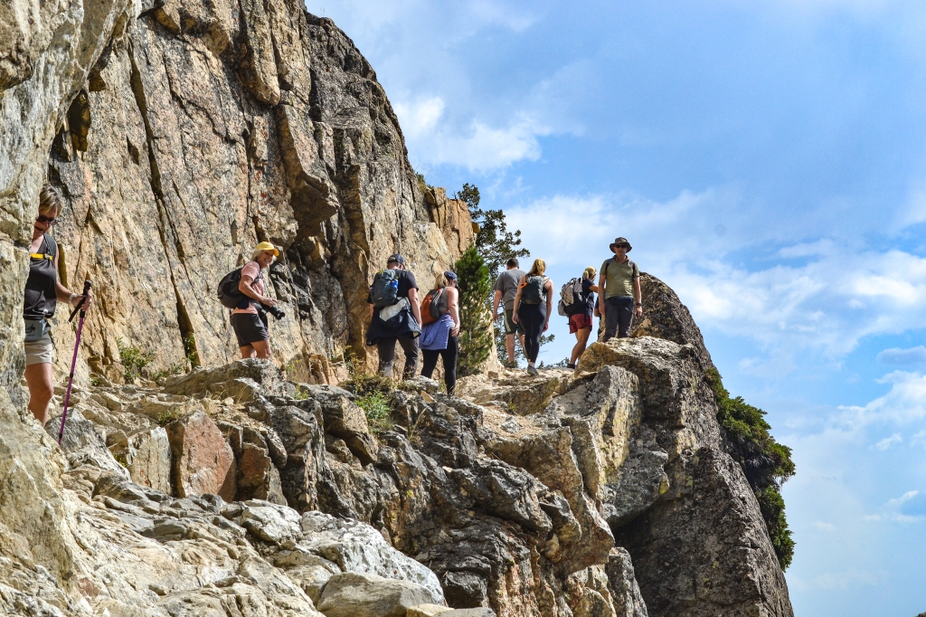


After making it to Inspiration Point, we learned there was still a bit of a hike to get to the moose. And who knew if they would even be there when we arrived. There was a bit of an elevation gain on this part of the hike, so it was slower hiking than earlier. The views going into the canyon were beautiful and the mountains rose so high all around us. Truly a moose paradise with a stream running along the left side which is where we later saw our prize animals!


We finished the hike and had lunch in the car and then visited Mormon Row (because everyone does that at the Tetons)! I was so glad we visited that once vibrant community. The homesteaders who settled near the turn of the 19th century, clustered their farms to share labor and community. There were 33 homesteads surrounding a church and school. Structures from six homesteads are still there. Pretty amazing area to visit. There were also free range bison that we could see and photograph (which I LOVE to do).


Our journey will continue tomorrow for the hunt for moose, a drive through the remainder of the park, and a search for some groceries. See you next time!
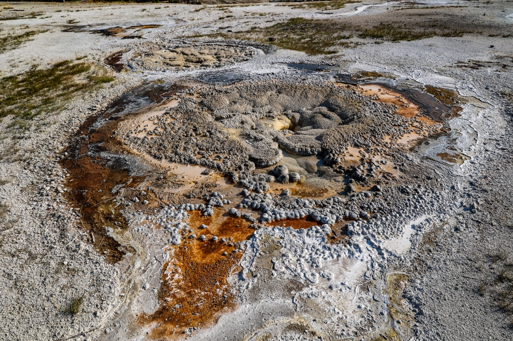
Mammoth Hot Springs are located on the Morris-Mammoth Fault and hot water rushes to the surface, carrying dissolved calcium and bicarbonate. The Minerva Terrace is one of the most colorful deposits of travertine in the park. It’s often inactive and then will become active, totally changing the look of the terrace. It seems to have natural stair steps stained with thermophiles. There are lots of geothermal features that can be viewed from the boardwalks and pathways. There’s also a 45 foot tall travertine deposit called Liberty Cap at the base of the Springs. The cone was thought to resemble the cap worn by Colonial patriot during the Revolutionary War. The boardwalk that’s at the hot springs connects to the upper and lower travertine levels so you can walk the entire way or you can walk and park your car for the upper and then move the car to do the lower. At the base of the springs is the Visitor’s Center. There’s lots of green grass there so it’s a favorite place for elk to hang out…especially during the September rutting season.


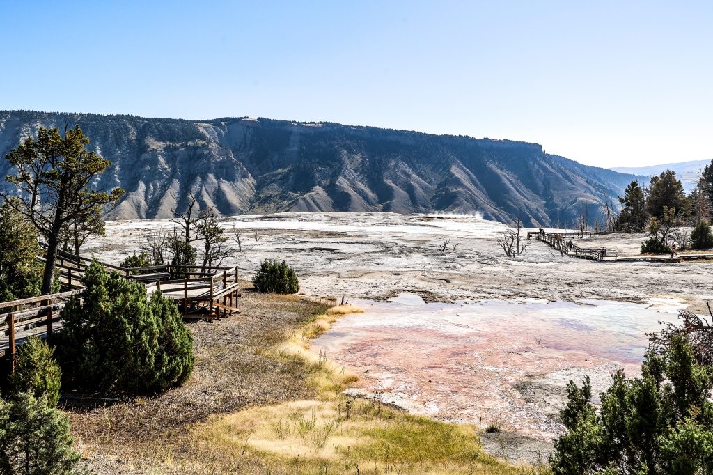


A network of fractures and fissures form the plumbing system that allows hot water from underground to reach the surface at Mammoth Hot Springs. The water comes from rain and snow falling on surrounding mountains and seeping deep into the earth where it is heated. Because of the rapid rate of deposition these features constantly and quickly change.


On our last return trip from Mammoth Springs to our campsite at the west entrance of Yellowstone, we passed Roaring Mountain which was on the Upper Loop Road. Roaring Mountain was named for the numerous fumaroles on its western slope. When we drove up to Mammoth Springs in the early morning, the coolness of the air combined with the heat of the fumarole caused lots of steam to be visible. On our return trip in the later part of the day, only two were showing. Fumaroles are vents in the surface of the earth and hot volcanic gases and vapors are emitted without any accompanying liquids. They say that when the steam is really bellowing, it sounds like jet planes taking off. We didn’t see or hear anything too exciting here but it was kind of cool to see a few of the fumaroles.


As we worked our way back home, we also stopped to see Sheepeater Cliffs. These are a series of exposed cliffs made up of columnar basalt. The lava was deposited about 500,000 years ago during one of the basaltic floods in Yellowstone Caldera.


One of the things that amazed me the most about Yellowstone was the ever-changing landscape. In each section of the loop road and around every bend it seemed like the landscape was always changing. We’ve left Yellowstone now and are in the Grand Teton National Park ready for our adventures to begin there tomorrow. I’ll leave you with some photos of the landscape of Yellowstone. Hope you enjoyed “our” trip together.


The tall, skinny pine trees above are called lodgepole pines. They’re very popular throughout the park. They have pinecones which have a seed inside and when they’re dropped and opened, they form a new tree. Some of the pinecones have a hard resin on them and they can only be opened when extreme heat is surrounding it such as in a fire. When the park has a forest fire (one not created by man), these seeds are able to pop out and begin growing a new pine tree, making it the first to grow back after a fire. Nature has such amazing ways of helping the area sustain itself. Remember when Yogi Bear used to say only you can prevent forest fires? A forest fire is one created by an act of nature such as a lightning strike. Now he says more correctly, “Only YOU can prevent wildfires”. See you next time from the Tetons!!
Did you know Yellowstone is larger than Rhode Island and Delaware combined for a total of over 2,000,000 acres of land??! That explains why it takes so long to cover all of the cool bits of nature and history and the landscape of Yellowstone. The area is so amazing with its ever-changing habitats of near-desert vegetation to subalpine meadows and forests. Because the park is divided into an upper and a lower loop, getting around to see everything is time-consuming. We were lucky with the crowds, though. With our visit being over Labor Day weekend, we were afraid it would be crowded but because the area is so immense and gas/campgrounds are expensive now, the park wasn’t as busy as normal. Having the north western and north eastern areas closed from the recent flood made it a little more difficult for people to get around as well. Luckily when I made the reservations a year ago, the west entrance was my choice and it didn’t suffer any flooding damage. The upper loop drive is 142 miles long and it’s all about waterfalls, hot springs, and great viewpoints. The lower loop drive is a little shorter at 96 miles and it’s home to Old Faithful and the hydrothermal attractions in the Lower and Upper Geyser Basin. We visited the Upper Geyser Basin again today with the hope of seeing more of the sights surrounding Old Faithful, and we even got to see her blow her stack again on that visit. There are a series of boardwalks and paved trails through this basin and we were able to see more geysers and hot pools without the crowds at Old Faithful. There we saw the highest concentration of geysers in the world. We passed stunning blue, orange and yellow pools and saw several unpredictable geysers erupt. We walked the 6 miles in the Upper Geyser Basin and saw many of the 150 thermal features in this area. Here are some we saw on our walk. (click on the first photo and scroll through to see more easily)


Notice how the different pools have different colors of water or even multi-colored rings in one pool? The hot springs are full of microbes that thrive in the hot pools. Different bacteria are responsible for the different colors and they thrive in pools based on the temperature and pH of the environment. Some were just amazingly beautiful. This was one of my favorite areas of the park. The hike took a couple of hours, partly because I stopped so frequently to take pictures and we were able to time it so that we saw Old Faithful erupt again. All along the boardwalk, pools were sizzling and bubbling and howling and erupting. Pretty exciting to see and to photograph. Here are a few more of this basin area.


We still had time left in our day so we drove back to the Madison area and took the middle part of the loop (it makes an 8 for the upper and lower loops and we cut across the middle part of the 8). The middle part took us to Canyon Village which we had been to previously to see the Grand Canyon of Yellowstone. We continued on the loop toward the northeast entrance which was actually closed due to the flooding. We had a day pass to go to Lamar Valley which is one of the most heavily populated areas in the park for seeing wildlife. You could only go 6 miles into that valley before the road was closed so we didn’t see a ton of wildlife but we did see a few things. I’ll include photos of them below. I love chasing wildlife and photographing them but the animals are in charge…they stop traffic with people leaning out of their cars to photograph them and the traffic jams are a nightmare. I usually jump out of the car and catch back up later since traffic doesn’t move much. We tried to do two hikes in the Lamar Valley area but September is a busy time for grizzlies and even with my bear spray, the constant warning signs freaked me out too much.


Lamar Valley where we saw the bison and other animals is near the eastern entrance which is closed because of the recent flooding and it’s also near the Tower-Roosevelt area of the park which was also closed. Along the upper loop to this area, we passed the Tower Fall which is a beautiful fall named so because of the towers all around the falls. The falls plunge a stunning 132 feet and the unusual rock columns north of the fall were created by lava flow that cracked as it cooled. In this area you can also see stunning views of the Yellowstone River and the volcanic cliffs, just north of Tower Falls in an area called The Narrows. The river flows through the valley and the yellowish walls of the cliff make the area stunning!!


